
• HOME
  • ABOUT
  • CONTACT
  • BOOKING
  • FLIGHT BLOG
Aerial Northwest | Oregon Drone Photography & Video ServicesAerial Northwest | Oregon Drone Photography & Video Services
  • HOME
  • ABOUT
  • FLIGHT BLOG
  • ORDER REAL ESTATE PHOTOGRAPHY
  • LET’S FLY!
  • CONTACT

Capturing Oregon King Tides: A Drone Pilot’s Guide

December 28, 2024 Posted by Tony Marino, MBA, Commercial Drone Pilot Drone Business Strategy Blog, Reel Oregon Coast, Top Drone Strategies
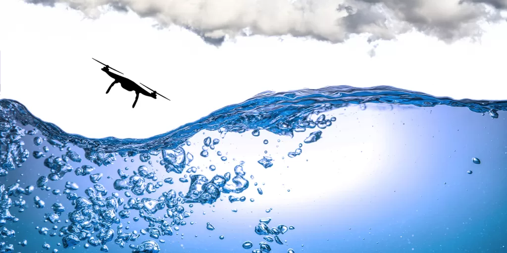
Aerial Northwest - Capturing Oregon King Tides - A Drone Pilot's Guide

The Oregon coast is gearing up for another round of King Tides from January 11-13, offering drone pilots a rare opportunity to capture breathtaking footage of nature’s raw power. These exceptionally high tides provide a spectacular canvas for aerial photography and videography, but they also demand a keen understanding of their timing, science, and associated risks.

What Are King Tides?

King Tides represent the highest tides of the year, occurring when the gravitational forces of the moon and sun align during full or new moons. This alignment creates the strongest tidal forces, leading to dramatically elevated water levels. Though King Tides are a natural phenomenon, their impacts are becoming more pronounced as sea levels rise due to climate change.

These tides are more than a visual spectacle; they offer a preview of what could become the norm as ocean levels continue to rise. Coastal flooding, erosion, and infrastructure damage are common side effects, particularly in low-lying areas.

Key Details About Oregon’s January King Tides

  • Dates: January 11-13, 2024
  • Locations: Coastal towns such as Depoe Bay, Cannon Beach, and Shore Acres State Park offer excellent vantage points to witness this natural phenomenon.
  • High Tide Timing: To maximize your shoot, consult tide tables for specific high tide times in your desired location. NOAA’s Tides and Currents provides an excellent resource for tide predictions.

Why Drone Pilots Should Care About King Tides

King Tides are a dream subject for drone pilots, offering:

  • Dramatic Visuals: Capture crashing waves, inundated coastlines, and rugged cliffs being reshaped by the ocean’s force.
  • Environmental Storytelling: Showcase the impact of rising sea levels and their implications for coastal communities.
  • Content Demand: High-quality drone footage of King Tides is valuable for tourism, environmental education, and news media.

Planning Your Flight

To make the most of your King Tides drone shoot, consider these steps:

1. Do Your Research

Familiarize yourself with King Tides using resources like NOAA’s King Tide Explanation and Tide and Current Data. Understanding the science behind the phenomenon helps frame your shots with context and purpose.

2. Scout the Best Locations

The Oregon coast boasts numerous scenic spots for observing King Tides. Here are some highlights:

  • Cannon Beach and Haystack Rock: Iconic rock formations make for dramatic backdrops.
  • Depoe Bay: Known for its rugged cliffs and “boiling” waves, it’s a drone pilot’s paradise.
  • Shore Acres State Park: Elevated viewpoints ensure safety while offering panoramic views of waves crashing against cliffs.

3. Prioritize Safety

Safety is paramount when flying during King Tides. Keep these tips in mind:

  • Maintain Distance: Avoid flying too close to waves, cliffs, or water spray that could damage your drone.
  • Monitor Weather: Unpredictable wind and rain can pose challenges; check forecasts and be prepared to adapt.
  • Avoid Hazardous Areas: Steer clear of jetties, trails near the waterline, and unstable cliffs.

4. Use the Right Equipment

  • Weatherproof Drone: Opt for a drone with weather resistance to handle mist and coastal conditions.
  • Filters: ND filters can help manage exposure in bright, reflective conditions.
  • Extra Batteries: Cold weather can drain batteries faster; bring spares to extend flight time.

Capturing the Moments

When filming King Tides, focus on:

  • Dynamic Angles: Showcase the contrast between land and sea by incorporating sweeping panoramas and close-up shots of waves hitting the shore.
  • Before-and-After Comparisons: Highlight the difference between normal and King Tide conditions to emphasize the tidal impact.
  • Community Impact: Document coastal flooding and erosion to tell a more

A Word on Responsibility

As ambassadors of the sky, drone pilots have a unique role in raising awareness about environmental issues. Use your footage to inspire action, educate audiences, and promote sustainable practices.

For more information about King Tides and safety precautions, visit OregonKingTides.net or consult NOAA’s Tide Resources.

Oregon State Parks: Restrictions

As a point of reference pertaining to certain Oregon State Park restrictions. This actual email between OPRD and our agency provides some clarification:
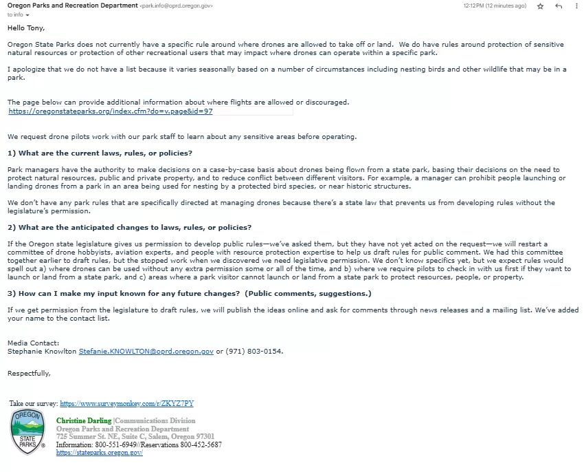
Drones In Oregon State Parks Letter

The Takeaway

Oregon’s January King Tides present an unparalleled opportunity for drone pilots to capture nature’s grandeur while telling an important environmental story. With proper planning, safety precautions, and a creative eye, you can create compelling content that resonates with audiences and showcases the untamed beauty of the Oregon coast.

If you have any questions, let us know! If you’d like to hire us, you can get more information here.

Written by: Tony Marino, MBA – FAA Certified Part 107 Commercial Drone Pilot and Chief Business Strategist at Aerial Northwest

Disclaimer: The information provided in this blog post is for general informational purposes only and should not be construed as legal advice.

Capturing King Tides on the Oregon Coast

King Tides Are Reshaping Oregon's Coastline Right Now

Resources

  • FAA Resources: FAA DroneZone
  • Oregon King Tides Project
  • NOAA Tides & Currents
  • NOAA High Tide Flooding Monthly Outlook
  • NOAA King Tides Explanation
  • NOAA Find Tides & Currents Tool
  • South Coast Tide Tables
  • Central Coast Tide Tables
  • North Coast Tide Tables
  • Oregon Parks and Recreation Department
  • National Weather Service – Oregon Coast

Starting Your Own Drone Service Business

Pick up your copy today on Amazon and wherever fine books are sold.

Take Flight - Start Drone Photography Business Under $1000

Drone Business Strategy Magazine

DRONE BUSINESS STRATEGY MAGAZINE

A free digital publication made exclusively for all small business drone pilots to them help start-up, become profitable while sustaining a competitive advantage within the drone service industry sector they opt to serve.


“If you love to fly, we’d love to have you come aboard!”

Loading

We share your information with no one. Our Privacy Policy.

Share

    About Tony Marino, MBA, Commercial Drone Pilot

    A proud US Navy veteran and a highly creative and impassioned FAA Certified sUAS Commercial Drone Pilot and predominately a straight-forward, "go-to" business expansion strategist and well-known critical thinker, Tony Marino draws upon his earned BSBA in Marketing (summa cum laude) and MBA in Entrepreneurship in lock-step with his real-world expert skill sets in the areas of business strategy, business leadership, creative writing, photojournalism, music, video, and television production, community networking, talent acquisition, linguistics, predictive forecasting, and business performance analyses. Tony has published over 200 articles on the subject of drone pilot business strategy.

    2 Comments

    Leave your reply.
    • Tobias
      · Reply

      January 9, 2025 at 9:43 AM

      Unfortunately, drones are not allowed at Shore Acres State Park.
      https://stateparks.oregon.gov/index.cfm?do=park.profile&parkId=68

      “Commercial and recreational use of a radio controlled aircraft, unmanned aircraft – “drones”, quad-copters’ and similar are prohibited at Shore Acres, Sunset Bay, Norton Gulch, and Cape Arago.”

      Unless you know something I don’t?

      • Tony Marino, MBA, Commercial Drone Pilot
        · Reply

        Author
        January 9, 2025 at 11:43 AM

        Happy New Year Tobias! Certain municipalities regulate takeoff and landing locations, even though airspace remains under FAA jurisdiction. For example, at Smith Rock State Park in Oregon, taking off and landing drones within the park boundaries is prohibited. However, pilots can operate from outside the park to capture their desired footage from the perimeter. In some cases, special permissions can be requested from municipalities for closer access. For more information about waivers and special use considerations, contact Oregon Parks and Recreation. Happy droning! 😉 T (More Info: https://www.faa.gov/uas/resources/community_engagement/no_drone_zone)

    Leave a Reply

    Your email is always safe with us.
    Cancel Reply

    This site uses Akismet to reduce spam. Learn how your comment data is processed.

    Advertisment

    Drone Flight Blog | Trending

    • The Drone Industry Has a Client Acquisition Problem
      The Drone Industry Has a Client Acquisition Problem
    • AI Real Estate Photography: Risks You Need to Know
      AI Real Estate Photography: Risks You Need to Know
    • The FAA Drone Crackdown: 7 Costly Mistakes
      The FAA Drone Crackdown: 7 Costly Mistakes
    • FAA DETER Program: Drone Compliance & Part 107 Risk
      FAA DETER Program: Drone Compliance & Part 107 Risk
    • Want More Listings and Referrals? Stand Out Like This
      Want More Listings and Referrals? Stand Out Like This

    Drone Pilot Resources

    Advertisment

    The Dark Side of the Drone Industry

    The drone industry is booming — but behind the cinematic footage and success stories lies a reality most pilots never see coming. In this episode of Drone Pilot MBA, Tony Marino pulls back the curtain on the hidden risks facing today’s drone business operators.

    Drone Resources

    • AirMap
    • Aloft
    • B4UFLY APP
    • DJI Drones
    • FAA Drone Zone
    • FAA IACRA
    • FAA Safety
    • SkyWatch Flight Insurance
    • Windy Weather APP

    Contact Us

    We're currently offline. Send us an email and we'll get back to you, asap.

    Send Message
    Salem Agency

    Since 1999, our mission as media producers and aviators is to render for each valued client guaranteed accurate, transparent, and cost-efficient results of the highest order – quickly, professionally, and proficiently.

    We know that our longstanding professional reputation is 100% dependent upon complete client satisfaction with each important mission we fly.

    We’d love to fly for you!

    Call Us Today! 503-389-5411

    Aerial Northwest - Tony Marino - Salem Agency

    DRONE FLIGHT OFFERINGS


    • Business Promotion

    • Creative Media

    • Documentary Production

    • Commercial Advertising

    • News & Entertainment

    • Residential Real Estate

    • Commercial Real Estate

    • Scientific Research

    • Search & Rescue

    • Inspection & Monitoring

    • Security & Surveillance

    • Weddings & Events

    • Full Multimedia Production Suite

    Social Channels

    Get In Touch

    • Aerial Northwest
    • 1050 Sunnyview Road, #7633 Salem, Oregon 97301
    • 503-389-5411
    • info@AerialNorthwest.com
    • https://AerialNorthwest.com

    AERIAL NORTHWEST


    • Pilot Strategy Blog

    • About Aerial Northwest

    • Our Portfolio

    • Our Leadership

    • Real Estate Photography

    • Booking & Onboarding

    • Career Opportunities

    • Books & Education

    • UAS Safety Reporting

    • Terms of Use

    • Privacy Policy

    • Data Privacy Policy

    • Cookies Notice

    • Legal Disclaimer

    Highly Recommended on Alignable
    Aerial Northwest - Tony Marino - Salem Agency
    Aerial Northwest - Wounded Warrior Project
    Aerial Northwest Supports the ASPCA

    © 2026 Aerial Northwest, LLC. All rights reserved. As an Amazon Associate, we earn from qualifying purchases.

    Prev Next