

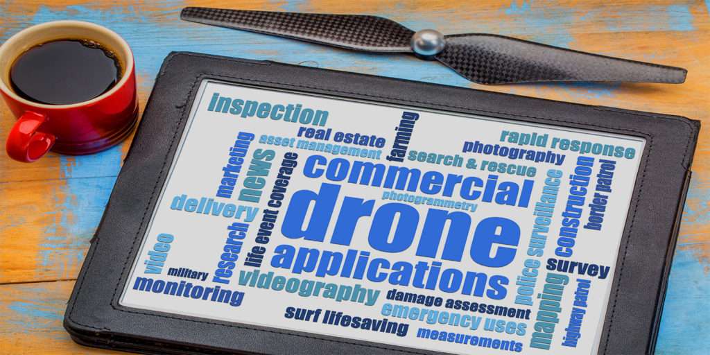
This high-level guide has been prepared as an overview to help you find the right aerial drone for your next project and beyond. Drones have become an increasingly popular tool in various industries, from photography and videography to surveying and agriculture. However, with so many options on the market, it can be overwhelming to know which drone is right for your specific needs. The key to making the best decision is to determine how you plan to use the drone, as this will dictate the features and capabilities you need.
So, let’s fly in and explore the different factors to consider when selecting an aerial drone for your project.
How Today’s Businesses Use Drones
If your business sector uses data collected from a physical space, there’s a good chance drone technology is making an impact.
Some of today’s top business sectors investing in unmanned aircraft innovative technologies include:
- Land Surveying
- Environmental Conservation
- Agriculture
- Firefighting
- Energy
- Mining
- Construction
- Law Enforcement
- Real Estate
- Historic Preservation
- Artistic Aerial Photography
Land Surveying
In the past, surveying professionals relied exclusively on terrestrial methods such as total stations, GPS receivers, and ground laser scanners to acquire their spatial data. Each of these processes are time-consuming and often quite costly. Fortunately there’s a new and smarter way to handle accurate land surveying projects.
Now, with the new leading-edge intelligence of drones, land surveyors can map out even the most challenging terrain faster and more precisely than ever before.
Aerial drone deployment reduces risk by eliminating the necessity for sending surveying crews out into hazardous environments while making it easier to collect meticulous data from inaccessible features like treetops and cell towers.
In addition to project time reduction, drone deployment can be a formidable asset for a surveyor by offering multiple mapping technologies including:
- 2D and 3D Orthomosaic Maps
- 3D Modeling
- Thermal Maps
- Multispectral Maps
- LiDAR Point Clouds
Each of these innovative aerial technologies may prove invaluable depending on the initiatives of a given surveying campaign.
Environmental Conservation
With relatively limited funding in contrast to many of the other industry sectors on our list, environmental researchers must be able to optimize every task according to their unique core task objective.
Significantly, scientists have discovered ingenious techniques to utilize drones for the good of our planet.
To map out fragile ecosystems and perform counts on endangered species, conservationists are using UAVs to attain a critical survey advantage. With this type of precise data available, environmentalists are able to better understand how to most efficiently distribute their essential resources and which specific environmental areas require prompt attention.
Agriculture
Farmers the world over have developed all types of practical uses for commercial UAVs.
Farmers of grain crops like wheat. rice, and corn are using drones to spot environmental shifts and to make better field management decisions to lower operating costs, render improved crop quality and increased yield rates.
Drones don’t just help farmers gather new information. Certain drones can swiftly fly over a field and spray crop fertilizer or pesticides as needed. Such drone missions measurably save farmers time and labor costs which now represents a giant leap forward for the agriculture industry at large.
Firefighting
Unfortunately, the last few years have presented an influx of wildfire activity across the country — a trajectory that likely will not ease up any time soon. Firefighters have diligently responded accordingly to this great challenge with intelligent innovation.
At each stage of a wildfire, unmanned aircraft systems can have a monumental impact.
Aerial drones give firefighters an advantage of observing a given area by providing a bird’s eye view of the terrain at the outbreak of a wildfire and help to accurately identify where the flames will move next — giving firefighters the instant ability to make quick decisions about where crews should go and which residents and businesses need to be evacuated.
Not only do drones help crew leaders save lives but also helps keep their firefighting teams out of harm’s way.
Controlled burns help fire teams strategically clear dry brush and other debris in a specific area ecosystem that could otherwise wind up fueling future wildfires. Drones play an integral role in forest fire prevention, helping firefighters set controlled, well-defined burns from safe distances.
Energy
Oil and gas companies deploy drones to better assess areas around pipelines to more accurately analyze varying environmental changes over a specific period of time. This is particularly important because some portions of these operations, such as flare tips and floating points are far more difficult to assess with fine precision from ground-level vantage points.
Another benefit to the energy sector is that aerial drone inspections reduce the time employees spend in risky conditions, such as near hot pipes that belch out dangerous toxins. Ultimately, by shifting from manual operations to aerial drone operations, the oil and gas industry is saving costly time on inspections while simultaneously sustaining greater safety for its employees.
Fossil fuel companies are not the only ones benefiting from UAV operations. By deploying aerial drones in tandem with remote laser sensors, solar farms are better able to inspect solar panels in record time with greater accuracy.
In the past, solar farms were limited by certain time constraints to conduct manual inspection operations. With the inception of UAVs, these companies can now freely grow while performing at a higher quality standard — translating to increased green energy deliverables for the greater good of our planet.
Mining
Safe and optimal mining operations require a great deal of information — sometimes more than a million data points for larger projects. Aerial drones help mine operators more efficiently gather much of this information. Drone photography is used to shave significant amounts of time from stockpile volume measurements — handling the measuring process 90% faster.
In addition to efficiently optimizing the way information is collected, UAVs are helping mine operators keep their employees safer. Instead of manually inspecting dangerous equipment, aerial drone pilots can be safely positioned from a greater distance and collect all of the project information needed.
Industries like mining, where toxic substances and formidable terrain can be abundant, the ability to work from extended distances is a true windfall for safety.
Construction
Mapping and modeling conducted aerial drones help construction managers make safer, better informed decisions. Architectural design, engineering design and construction firms can use the latest drone technologies to create 3D models of projects that gather data right to the centimeter while accurately stockpiling volume metrics. From the pre-planning stage to supply chain optimization, the rendered results measurably speak for themselves.
Law Enforcement
During traffic stops and to help conduct missing people searches, law enforcement entities are deploying aerial (and even ground-based) drones to gather critical real-time information.
Should a suspect flee a given crime scene, law enforcement officers can use an aerial drone to track them and to plan the best course of action for interception that could otherwise instigate mayhem and greater overall risk that a manned vehicle chase may incur.
Drones like these can also be used to check police conduct and ensure officers are following standard procedures during traffic stops.
Aerial drone operations are also helping first responders by way of remote sensor and thermal imaging capabilities to locate bodies in search and rescue missions. With law enforcement and first responder teams commonly working in darkness with hair-line time margins, the right aerial drone technology can make the difference between life and death.
Real Estate
Realtors are not only using aerial drones as a powerful marketing force, capturing professional aerial real estate photography and videography, they now are using aerial drones to make accurate 3D models of homes for sale and the capability to offer unique virtual home tours, giving prospective renters and buyers the ability to view a property remotely.
Insurance
Aerial drones help to make insurance inspections easier and more time- and cost-efficient by delivering accurately defined needed property valuations. Aerial drones help insurers gather as much information as possible.
Due to the large amount of data that can be gathered from an aerial drone, insurance companies can now more cost-efficiently rely on a single generalist contractor rather than paying multiple teams to conduct such inspections.
Factors that insurers look for in these inspections include:
- Existing damage
- Potential risk (natural disaster like flooding)
- Potential fraudulent claims
In some circumstances, a single drone flight mission can be enough to gather all needed images for a specific evaluation.
Historic Preservation
Scientists, particularly archeologists, are calling upon aerial drone technologies for mapping and modeling to discover new insights about some of our world’s most important historic locations.
Aerial drones are used to collect data prior to a dig, while helping teams optimize the way they plan, work, identify new historic assets, and to acquire a greater understanding of the architecture of a given building. In fact, archeologists used an aerial drone to generate a 3D point cloud model of the 17th century, “Karatsu Castle.”
Artistic Aerial Photography
Aerial drones are now a “go-to” for professional photographers who use an unmanned aircraft to take high-definition aerial photographs and videos.
From landscapes to wedding ceremonies and from Hollywood films to special events, commercial aerial drone pilot photographers are flying such aerial missions across the globe with UAVs specifically developed, engineered, and manufactured to capture desired destinations from above.
The Takeaway
Finding the right aerial drone for your next project requires careful consideration of your specific needs and intended use. By assessing factors such as flight time, camera capabilities, and payload capacity, you can identify the drone that will best serve your goals. Additionally, it’s essential to keep in mind factors such as budget, regulations, and maintenance requirements when making your selection. With the right drone in hand, you can capture stunning aerial footage, conduct surveys and inspections, and even deliver goods with ease. We hope this guide has been helpful in your search for the perfect aerial drone, and we wish you the best of luck in your future projects.
Be smart, safe, and forever fly!
If you have any questions, let us know! If you’d like to hire us, you can get more information here.
Written by: Tony Marino, MBA – FAA Certified Part 107 Commercial Drone Pilot and Chief Business Strategist at Aerial Northwest
DRONE BUSINESS STRATEGY MAGAZINE
A free digital publication made exclusively for all small business drone pilots to them help start-up, become profitable while sustaining a competitive advantage within the drone service industry sector they opt to serve.
“If you love to fly, we’d love to have you come aboard!”
We share your information with no one. Our Privacy Policy.






Leave a Reply
Your email is always safe with us.