

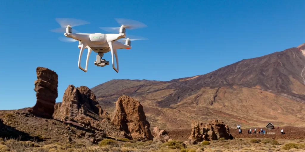
As the world of commercial drones continues to soar to new heights, the role of the commercial drone pilot is more critical than ever. With each mission, pilots face unique challenges and must navigate complex environments. Among the many essential tasks for a successful mission, location scouting stands out as a crucial step.
In this article, we will delve into the significance of location scouting, its benefits, potential pitfalls, and provide a comprehensive guide for conducting both physical and online location scouting.
Plus, don’t miss our free download of the “Aerial Drone Location Scout Checklist” template to ensure your scouting process is thorough and systematic.
What is Location Scouting?
Location scouting is the fundamental and meticulous process of surveying and evaluating the designated area where a commercial drone mission is set to take place. It is a crucial initial step that lays the foundation for a seamless and effective aerial operation. In essence, location scouting serves as the blueprint for the entire mission, and its significance cannot be overstated.
This comprehensive procedure involves a systematic assessment of the surroundings, an examination of potential obstacles, and a thorough analysis of any potential risks that might be encountered during the course of the flight. To grasp the essence of location scouting, one must envision it as the equivalent of a cartographer charting unexplored territory, ensuring that the path is clear, safe, and that every detail is taken into consideration.
Here’s a more detailed breakdown of what location scouting entails:
- Environmental Evaluation: The natural environment is a crucial aspect of location scouting. This includes understanding the terrain, vegetation, weather conditions, and any potential changes in the environment that may affect the flight. Evaluating environmental factors is pivotal, as they can directly impact the drone’s performance and the quality of data it can capture.
- Obstacle Identification: During location scouting, keen attention is paid to identifying and cataloging potential obstacles. These obstacles can vary from physical structures like buildings, trees, and power lines to more dynamic elements such as moving vehicles and people. Recognizing these potential obstructions is essential for flight safety and mission success.
- Risk Assessment: Safety is of paramount importance in any drone operation. Location scouting involves a rigorous risk assessment process. This means evaluating not only the risks associated with obstacles but also understanding the potential for interference with other aircraft, wildlife presence, and even unforeseen challenges that could arise during the flight.
- Airspace Analysis: Understanding the airspace is an integral part of location scouting. Pilots need to be aware of any restricted or controlled airspace areas, as well as any no-fly zones that may exist in proximity to the chosen location. This knowledge ensures compliance with aviation regulations and helps avoid legal issues.
- Data Collection Requirements: Depending on the nature of the mission, location scouting also involves determining the specific data collection requirements. This could include the altitude and angle at which images or videos need to be captured, the type of sensors and equipment needed, and the intended flight path.
Location scouting is the bedrock of safe and successful drone missions. It is a meticulous process that involves assessing the environment, identifying obstacles, analyzing risks, and understanding the specific data collection needs. Without this critical step, the drone pilot would be navigating uncharted territory blindfolded, potentially leading to hazardous situations and failed missions.
Why is Location Scouting Critical?
Location scouting plays a pivotal role in the overall success of any commercial drone mission. Here’s a more in-depth exploration of why location scouting is so critical:
a. Safety First: Ensuring the Safety of People and Property
Safety is the paramount concern in every drone operation. Location scouting acts as the guardian of safety by meticulously identifying and addressing potential hazards before they have the chance to escalate into dangerous situations. Here’s how location scouting contributes to safety:
- Obstacle Detection: Location scouting helps pinpoint physical obstacles such as trees, buildings, and power lines that could pose a collision risk for the drone. By identifying these in advance, pilots can plan their flight paths to avoid them, preventing accidents that could result in damage to the drone, property, or, worst of all, harm to individuals.
- Risk Mitigation: Beyond physical obstacles, location scouting also uncovers less tangible risks, like crowded public spaces or wildlife activity. Knowing about these potential risks in advance enables pilots to take proactive measures to mitigate them, thereby enhancing the safety of everyone involved.
- Emergency Preparedness: Location scouting allows drone pilots to pre-determine safe landing zones and emergency procedures. In the event of a system malfunction or unforeseen challenges, this foresight can make the difference between a minor setback and a major incident.
b. Regulatory Compliance: Navigating the Legal and Airspace Landscape
Commercial drone operations are subject to a complex web of regulations and airspace restrictions. Location scouting is an invaluable tool for ensuring that these regulations are adhered to, which is vital for a lawful and hassle-free mission. Here’s how location scouting aids in regulatory compliance:
- No-Fly Zones and Restricted Areas: Many regions have designated no-fly zones and restricted areas for various reasons, such as security, privacy, or environmental concerns. Through location scouting, drone pilots can identify and steer clear of these areas, thus avoiding potential legal issues and protecting sensitive locations.
- Airspace Awareness: Understanding the specific airspace in the vicinity of the mission site is imperative. Location scouting enables pilots to ascertain whether they need to request permission from air traffic control or relevant authorities, ensuring they are in compliance with aviation regulations.
c. Mission Success: Maximizing the Chances of Success
Ultimately, the success of a drone mission depends on the quality of data collected, adherence to the mission objectives, and client satisfaction. A well-scouted location significantly contributes to these aspects:
- Data Collection Efficiency: By thoroughly assessing the location beforehand, pilots can plan efficient flight paths that maximize data capture and minimize redundancy. This leads to higher-quality results and more productive missions.
- Client Satisfaction: A mission that runs smoothly due to careful location scouting leads to satisfied clients. It demonstrates professionalism and reliability, which can result in repeat business and positive recommendations.
Location scouting is an indispensable cornerstone of mission planning. It not only upholds safety and regulatory compliance but also paves the way for mission success by minimizing unexpected challenges and ensuring data collection efficiency. In the world of commercial drone operations, the difference between a well-scouted location and a hastily chosen one can mean the distinction between a thriving mission and one fraught with problems.
Benefits of a Well-Executed Location Scout
Conducting a thorough and well-executed location scout can be likened to fortifying the foundation of a building. It ensures that the mission is built on a solid platform, and the benefits are both tangible and invaluable:
1. Risk Mitigation: Ensuring Safe Operations
One of the most immediate and critical benefits of a well-executed location scout is risk mitigation. By identifying and addressing potential hazards and challenges before the mission, drone operators significantly enhance safety in the following ways:
- Collision Prevention: Through location scouting, potential obstacles like trees, buildings, and power lines are flagged and accounted for. This early identification allows for informed flight path planning, reducing the risk of mid-air collisions and damage to the drone, property, or, most importantly, injury to people.
- Unforeseen Obstacles: Beyond physical obstacles, location scouting unveils less conspicuous risks, such as unexpected weather changes or wildlife activity. Recognizing and mitigating these risks in advance is fundamental to safe operations and ensures that the mission proceeds without endangering anyone or anything in its path.
- Emergency Preparedness: In the event of unforeseen circumstances or equipment malfunctions, a well-scouted location provides a plan B. Pilots can pre-determine safe landing zones and have an established understanding of the local terrain, which is crucial for quick and efficient decision-making during emergencies.
2. Enhanced Efficiency: Optimizing Flight Paths and Data Capture
Efficiency is at the heart of every successful drone mission, and a well-executed location scout contributes significantly to optimizing operations in the following ways:
- Strategic Flight Planning: Through location scouting, pilots can strategically plan flight paths that are not only efficient but also designed to capture the required data with precision. This strategic approach minimizes flight time and conserves energy, increasing overall mission efficiency.
- Reduced Redundancy: Redundant data collection is a common pitfall in drone missions. A well-scouted location helps identify areas that need to be covered and areas that can be omitted, reducing the chances of duplicate data and, by extension, mission costs.
3. Client Satisfaction: Delivering High-Quality Results
Client satisfaction is the ultimate goal of any commercial drone mission, and a well-executed location scout directly contributes to this by ensuring:
- High-Quality Results: Location scouting facilitates the acquisition of high-quality data by reducing the chances of unforeseen challenges during the mission. This means that the data collected is more accurate, reliable, and in line with the client’s expectations.
- Minimal Disruptions: A well-scouted location allows for smoother operations. There are fewer disruptions, which not only save time but also showcase professionalism and reliability to the client. This leads to a positive client experience and can result in repeat business and positive referrals.
A well-executed location scout is not just a preparatory step in commercial drone operations; it’s a strategic investment. The benefits encompass not only safety, efficiency, and high-quality results but also the potential for long-term client satisfaction and a solid reputation in the industry. It’s the difference between a mission that merely takes flight and one that soars with excellence.
Pitfalls of Neglecting Location Scouting
While the importance of location scouting cannot be overstated, neglecting this crucial step can lead to a series of detrimental consequences that not only jeopardize the success of the drone mission but can also pose significant risks and legal challenges:
1. Safety Hazards: Unforeseen Obstacles and Risks
Neglecting location scouting opens the door to a host of safety hazards, endangering both people and equipment:
- Collision Risks: Without prior location scouting, drone operators may encounter unexpected obstacles such as tall buildings, power lines, or dense vegetation during the flight. These unanticipated hazards pose a serious risk of mid-air collisions, which can result in property damage, injury to bystanders, or even catastrophic accidents.
- Environmental Hazards: Environmental factors, like sudden weather changes, can have a profound impact on drone operations. Without prior knowledge of these changes, drone operators may inadvertently fly their drones into hazardous weather conditions, putting the safety of the equipment and the surrounding environment at risk.
- Wildlife Encounters: In some locations, wildlife activity can be unpredictable. Neglecting location scouting can lead to unexpected encounters with birds, animals, or other wildlife, potentially causing the drone to lose control and crash.
2. Legal Consequences: Violation of Airspace Regulations
Location scouting is not only about ensuring safety but also about adhering to the law. Neglecting to scout the location can result in serious legal consequences, including:
- Airspace Violations: Failure to conduct location scouting may lead to unintentional violations of airspace regulations. These violations can result in fines, legal repercussions, and damage to a drone pilot’s professional reputation. In some cases, operators might even face suspension of their drone licenses.
- Privacy Infringements: Without proper location scouting, operators may inadvertently breach privacy laws by capturing images or data in restricted or sensitive areas. This can lead to legal disputes and tarnish the reputation of the drone operator or the company they represent.
3. Failed Missions: Poor Data Collection and Mission Failure
Perhaps the most immediate and tangible consequence of neglecting location scouting is the potential for mission failure:
- Data Quality Issues: Lack of location scouting can result in poor data collection. Obstructed views, incomplete data sets, or data inaccuracies due to unforeseen challenges can render the entire mission less valuable or even useless for its intended purpose.
- Operational Failures: In the absence of location scouting, missions can encounter unexpected difficulties that compromise the entire operation. Equipment malfunctions, navigational challenges, and flight disruptions can lead to mission failure and financial losses.
Neglecting location scouting is akin to taking off on a journey without a map or GPS. It not only endangers safety and legality but also increases the likelihood of mission failure. In the world of commercial drone operations, meticulous location scouting is the key to unlocking success, compliance, and a sterling safety record.
Steps for a Proper Location Scouting Process
A thorough and well-organized location scouting process is the backbone of a successful drone mission. To ensure that your location scouting is comprehensive and effective, follow these numbered steps:
1. Define Mission Objectives: Understand the Purpose of the Drone Mission
Before setting out on a location scouting mission, it’s essential to have a crystal-clear understanding of the mission’s purpose and objectives. This foundational step involves:
- Identifying the specific data or imagery required, such as aerial photographs, topographical data, or thermal imaging.
- Clarifying the goals and deliverables for the client, ensuring that your scouting efforts align with their expectations.
2. Research Regulations: Familiarize Yourself with Local Drone Laws
Compliance with local, regional, and national drone regulations is non-negotiable. To avoid legal pitfalls, begin by:
- Thoroughly researching the local drone laws and regulations applicable to your intended location.
- Identifying any no-fly zones, restricted airspace, or specific permitting requirements.
- Ensuring that you are well-versed in the legal framework governing drone operations in the area.
3. Online Tools: Use Online Mapping Resources
Online mapping tools and resources are indispensable for gathering essential data about the location, even before you physically set foot there. Here’s how to make the most of these digital assets:
- Utilize satellite imagery and topographical maps to gain insights into the location’s terrain, features, and possible obstructions.
- Identify points of interest, key landmarks, and notable geographical characteristics using tools like Google Earth or specialized GIS platforms.
- Cross-reference online resources to pinpoint potential challenges or areas of interest relevant to the mission.
4. On-Site Inspection: Assess Real-World Conditions
Whenever possible, conduct a physical on-site inspection to get a real-world feel for the location. This step involves:
- Visiting the location to examine its current state, assess any recent changes, and gain firsthand knowledge of the environment.
- Capturing visual or environmental details that may not be readily apparent in satellite imagery, such as ground conditions and potential access points.
- Engaging with locals, landowners, or stakeholders to gather insights or address specific questions about the site.
5. Identify Risks: Document Potential Hazards and Obstacles
Carefully documenting potential risks and obstacles is a vital component of location scouting. This includes:
- Identifying physical obstacles like buildings, trees, power lines, or other structures that may pose collision risks.
- Recognizing environmental factors such as weather patterns, seasonal variations, or wildlife activity that could affect the mission.
- Noting any potential risks that might arise from the local community or other factors, such as public events or construction projects.
6. Flight Planning: Create a Safe and Efficient Flight Plan
With a comprehensive understanding of the location, it’s time to develop a well-thought-out flight plan that optimizes safety and data collection efficiency. This step entails:
- Determining the optimal flight paths and altitudes to capture the required data while avoiding obstacles and risks.
- Planning waypoints, flight duration, and any specific mission parameters relevant to the objectives.
- Developing contingency plans and emergency procedures to handle unexpected situations.
7. Documentation: Compile Findings, Permits, and Regulations
As the final step of your location scouting process, compile all your findings, permits, and regulations into a comprehensive mission plan for reference. This includes:
- Documenting all location information, such as identified risks, flight paths, and access points.
- Ensuring that you have obtained any necessary permits or clearances required for the mission.
- Creating a mission plan that outlines the entire operation, including the objectives, safety protocols, and regulatory compliance measures.
A well-executed location scouting process is the cornerstone of a successful drone mission. By following these steps, you can ensure that your scouting efforts are thorough, compliant with regulations, and ultimately lead to a safe and productive aerial operation.
Conducting Online Location Scouting
In some cases, a physical visit to the location may not be feasible due to geographical constraints or other logistical challenges. In such situations, online location scouting becomes a valuable alternative. By harnessing digital tools and resources, drone operators can still gather essential information and prepare for their mission effectively. Here are the strategies for conducting online location scouting:
1. Use Satellite Imagery: Online Satellite Imagery for Topographical Insights
Online satellite imagery is a powerful resource that provides valuable insights into the location’s topography and potential obstructions. This step is essential for understanding the lay of the land and identifying potential challenges. Here’s how to make the most of this resource:
- Access Reliable Satellite Imagery: Use reputable platforms like Google Earth, Bing Maps, or specialized geographic information systems (GIS) services. These platforms often offer high-resolution satellite imagery that provides a detailed view of the area.
- Examine Terrain and Obstacles: Analyze the satellite images to identify natural and man-made features. Look for elevation changes, bodies of water, forests, urban developments, and any elements that may impact the flight path or data collection.
- Plan Flight Paths: Use the satellite imagery to create preliminary flight paths. Consider the optimal altitude for data capture and identify areas of interest for specific data collection objectives.
2. Review Local Regulations: Understand Drone Laws and Airspace Regulations
Compliance with local drone laws and airspace regulations is paramount, even when conducting online location scouting. Failing to adhere to these regulations can have serious legal consequences. Here’s how to navigate this aspect:
- Research Government Websites: Visit official government websites or aviation authorities’ platforms that provide up-to-date information on drone regulations and airspace restrictions. These resources often detail no-fly zones, permitting requirements, and other relevant rules.
- Use Mobile Apps: Some countries and regions have mobile apps that allow you to access real-time information on airspace regulations, weather conditions, and flight restrictions. These apps can be invaluable tools for understanding the airspace you intend to operate in.
- Cross-Reference Information: Double-check the regulations from multiple sources to ensure accuracy and currency. Regulations can change, so it’s crucial to stay informed.
3. Seek Local Knowledge: Connect with Experts and Community
Despite not being physically present, you can tap into local knowledge and expertise by connecting with local drone operators and online forums. This can provide insights and tips that are specific to the area:
- Online Drone Communities: Join online forums, social media groups, or discussion boards where local drone operators share their experiences and knowledge. These platforms are excellent for asking questions and learning from others who have operated in the area.
- Consult Local Experts: Reach out to local drone operators or professionals who are familiar with the area. They can provide valuable insights, such as weather patterns, common challenges, and recommended flight paths.
- Ask Specific Questions: When seeking local knowledge, be sure to ask specific questions related to your mission. Whether it’s about weather conditions, unique geographical features, or challenges related to your objectives, detailed inquiries can yield the most relevant information.
Online location scouting is a practical and effective approach when a physical visit to the location is not possible. By utilizing satellite imagery, understanding local regulations, and connecting with local experts, drone operators can gather essential data, ensure regulatory compliance, and enhance their mission preparedness, even when they can’t be on-site.
Conclusion: The Takeaway
Mastering the art of location scouting is a critical skill for commercial drone pilots. By conducting thorough scouting, you enhance safety, ensure compliance with regulations, and increase the likelihood of mission success.
Remember, whether you’re physically visiting the location or conducting online scouting, attention to detail is key to your success as a drone pilot.
Be smart, safe, and forever fly!
If you have any questions, let us know! If you’d like to hire us, you can get more information here.
Written by: Tony Marino, MBA – FAA Certified Part 107 Commercial Drone Pilot and Chief Business Strategist at Aerial Northwest
Disclaimer: The information provided in this blog post is for general informational purposes only and should not be construed as legal advice.
Resources
DRONE BUSINESS STRATEGY MAGAZINE
A free digital publication made exclusively for all small business drone pilots to them help start-up, become profitable while sustaining a competitive advantage within the drone service industry sector they opt to serve.
“If you love to fly, we’d love to have you come aboard!”
We share your information with no one. Our Privacy Policy.





Leave a Reply
Your email is always safe with us.