

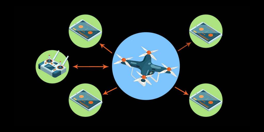
The implementation of FAA regulated aerial drone (UAS) Remote ID technology has been in the works for quite some time. The development and issuance of new policies and existing policy changes sometimes bring about confusion, suspicion, and pushback.
On Monday, November 22, 2021, the FAA posted a new policy statement pertaining to key requisites for unmanned aircraft systems (UAS) in conjunction with the FAA’s recently enacted rules for UAS Remote ID entitled, “Policy Statement for the Reported Geometric Altitude of the Control Station of a Standard Remote Identification Unmanned Aircraft.”
The purpose of this action is to clarify FAA policy regarding the existing accuracy requirements for the reported geometric altitude of the control station of a standard remote identification unmanned aircraft. Additionally, the FAA provides an acceptable example of how producers of unmanned aircraft can meet minimum performance regulations for the accuracy of the control station’s reported geometric altitude. The FAA believes this action is essential to inform developers of means of compliance of one potential pathway to meet the performance requirement for the control station’s reported geometric altitude.
8 Remote ID Message Elements
Part 89 requires the following 8 message elements to be broadcast from a standard remote identification unmanned aircraft:
- Unmanned aircraft unique identifier
- An indication of the control station’s latitude and longitude
- An indication of the control station’s altitude
- An indication of the unmanned aircraft’s latitude and longitude
- An indication of the unmanned aircraft’s altitude
- A time mark
- An indication of the emergency status of the unmanned aircraft system
- Velocity
Remote ID Minimum Requirements
Additionally, all standard remote identification unmanned aircraft must meet certain minimum requirements regarding the transmission of the message elements including the minimum performance requirements related to positional accuracy, geometric altitude accuracy, message latency, and message transmission rate. These minimum performance requirements for the message elements are design requirements; any specific test method for ensuring that the unmanned aircraft design meets this accuracy requirement will be reviewed and evaluated by the FAA as a part of the means of compliance acceptance process.
Individuals violating any of these rules, and/or operating in a dangerous manner, may be subject to FAA enforcement action.
Remote ID: March 2023 Update
Greg Reverdiau at Pilot Institute produced this presentation to show you how to find out if you are compliant with remote ID. Greg covers four of the major manufacturers and explains how to check your drone’s status and more inside the FAA Drone Zone.
FAA Extends Remote ID Enforcement Date Six Months | Update September 2023
Drone pilots who are unable to comply with the broadcast requirement of the Remote ID Rule will now have until March 16, 2024, to equip their aircraft. After that date, operators could face fines and suspension or revocation of pilot certificates.
In making this decision, the FAA recognizes the unanticipated issues that some operators are experiencing finding some remote identification broadcast modules.
Drone pilots can meet this deadline by purchasing a standard Remote ID equipped drone from a manufacturer or purchasing a Remote ID broadcast module which can be affixed to existing drones that do not have Remote ID equipment.
Remote ID acts like a digital license plate and will help the FAA, law enforcement, and other federal agencies find the control station when a drone appears to be flying in an unsafe manner or where it is not allowed to fly.

The Takeway | Aerial Drone Remote ID and Staying Informed
As the aerial drone (UAS) industry continues its safe ascent, we can all be sure that new rules will be enacted and regulatory changes will occur. Notably, we are an integral part of an industry that requires we as drone pilots stay informed, well-trained, and highly intelligent whenever taking to the sky. Thus, for informational purposes and to get caught up, you can read the FAA’s final rule for “Remote Identification of Unmanned Aircraft.”
Be smart, safe, and forever fly!
If you have any questions, let us know! If you’d like to hire us, you can get more information here.
For Further Information Contact
Paul Siegmund, Policy and Innovation Division, Federal Aviation Administration, 800 Independence Ave. SW, Washington, DC 20591; telephone 1-844-FLY-MY-UA (1-844-359-6981); email: UAShelp@faa.gov.
Free UAV Remote ID Resources
User Guide for FAA Remote ID Compliance
Written by: Tony Marino, MBA – FAA Certified Part 107 Commercial Drone Pilot and Chief Business Strategist at Aerial Northwest
Disclaimer: The information provided in this blog post is for general informational purposes only and should not be construed as legal advice.
DRONE BUSINESS STRATEGY MAGAZINE
A free digital publication made exclusively for all small business drone pilots to them help start-up, become profitable while sustaining a competitive advantage within the drone service industry sector they opt to serve.
“If you love to fly, we’d love to have you come aboard!”
We share your information with no one. Our Privacy Policy.





Leave a Reply
Your email is always safe with us.