

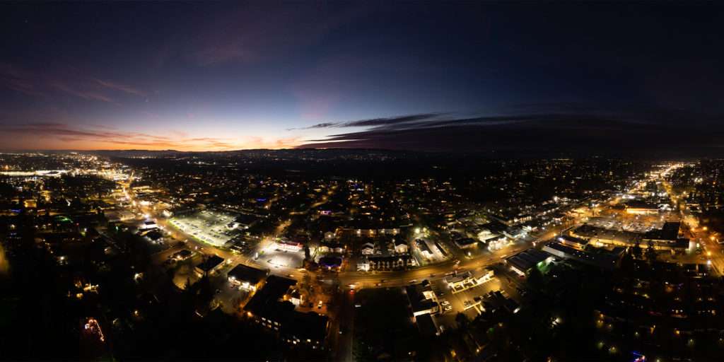
These days aerial drones are being used in many ways to accomplish many things. Although aerial photography – in one form or another – has been around for decades, aerial photographic capabilities – once upon a time – could only be skillfully accomplished by manned aircraft. Through new innovation, cutting-edge aerial drone technology, and ever more increasing market demand, extreme high-resolution aerial photography can now be performed more safely, more affordably, more creatively, more flexibly, and more precisely; delivering a positive trajectory for the aerial drone industry worldwide.
As aerial drone pilots continue to plan for and take to the Oregon skies, the FAA, other regulatory bodies, and the general public are all starting to better understand the collective effort needed to more safely maintain airspace and better protect people and property below. This process is now taking place throughout Oregon by way of open, on-going conversation, the enactment of certain critical drone laws, and the analysis of vital drone pilot flight information.
Oregon Drone Service Types
All across Oregon, from Baker to Bend, Astoria to Brookings, and the Willamette Valley to Medford, commercial aerial drone pilots and their unmanned aircraft systems are significantly supporting these specific business, community, and government industry sectors:
- Agriculture
- Business Promotion
- Creative Media
- Inspection & Monitoring
- Logistics & Delivery
- Mapping & Surveying
- News & Entertainment
- Real Estate
- Scientific Research
- Search & Rescue
- Security & Surveillance
- Aerial Wedding Photography & Events
Commercial Aerial Photography: How Drones Are Used Across Oregon
Agriculture
Throughout Oregon agriculture aerial drones are flown to accomplish precision agriculture, to efficiently disperse weed control and fertilizers; optimizing field management. The results are a reduction in operational costs, better crop quality, and greater yield.
Business Promotion
On behalf of Oregon businesses, aerial drones are being deployed to either direct or complement local and national ad agency marketing campaigns. Aerial drone photographers and videographers are delivering dramatic aerial views – unprecedented when compared to ground-level captured media.
Creative Media
Oregon aerial drone pilots take to unique destinations as these outdoor locales are sought and used for filming those extreme shots that require adrenalin-filled action sequences, authentic birds’ eye views, dramatic vistas, and even 360-degree views of specifically desired subjects. Like commercial aerial drones from all across the globe have discovered, Oregon dronographers too understand that no other moving picture method can call a sequence to action from within a building and wind up at 400 feet in one take.
Inspection & Monitoring
In Oregon, aerial drones support a wide array of vital inspection projects. By deploying an unmanned aircraft into a situation that would be dangerous for a humans, like down into a dark and narrow chimney or up a cell phone tower, certified and highly-trained aerial drone pilots (inspectors) are able to record accurate visual data about the precise condition of a particular asset without exposing themselves or others to avoidable danger.
Logistics & Delivery
Oregon aerial drone pilots and state and federal regulators are ramping up autonomous aerial drone delivery services used to aeronautically transport packages, food, medical supplies, or other goods.
Mapping & Surveying
Aerial drone technology has presented huge potential for surveyors and GIS professionals in Oregon. Aerial drone technology reduces the cost and hours of data capture. Aerial drone pilots are able to survey otherwise unreachable areas and render high-resolution aerial mapping that would be nearly impossible to reproduce using a safer or more cost-effective strategy.
News & Entertainment
Drone journalism refers to the use of drones for news gathering purposes. Aerial drone photography and videography missions lend a unique bird’s eye perspective to everyday news coverage, allowing Oregon journalists to make their reports more insightful and innovative.
For the Oregon film industry, drones provide new aerial perspectives, enhancing visual experience and capturing new and interesting vantage points of our world. Camera cranes, steadicams and camera tracks all have specific physical constraints. Drones can replace land-based equipment – including jibs and dollies.
Real Estate
Aerial drones across Oregon are being called to fly for all types of real estate listings including commercial properties, residential homes, apartments, vacant land, resorts, and more. Present aerial drone camera technology is commercially capable of capturing still images, video, multiple overhead map images, and 360 degree panoramas.
Scientific Research
To better protect and care for Oregon’s precious wildlife, aerial drones sent up to count, measure, and study animals to help keep them from harm. Aerial drones are far more precise at counting species and capturing monumental quantities of data far faster than a scientist could and from a bird’s-eye view, providing them a measurable advantage over traditional field research.
When it comes to Oregon’s perpetual seismic activity, drone-mounted gas monitoring equipment can be flown through volcanic plumes to directly measure the gases that geologists use to help predict eruptions.
Search & Rescue
Across the board, search and rescue teams across Oregon use aerial drones and their superior visual capabilities to proficiently generate situational awareness, plot rescue schemas, and directly and accurately relay messages to individuals once discovered — all while ensuring personnel safety at controlled and protected distances.
Security & Surveillance
An increasing amount of Oregon law enforcement agencies call upon drones to police more efficiently. Law enforcement agencies in Oregon use aerial drones to identify and collect evidence and conduct enhanced surveillance operations. Some Oregon agencies are already using unmanned aerial vehicles to photograph traffic crash or crime scenes, observe correctional facilities, track escaped prisoners, control crowds, and various other essential law enforcement tasks.
Some security firms in Oregon are teaming up with aerial drones technology to scan for persons who might not have authorized entry into secured area, investigate for vandalism, digitally scour for weather damage, and to help more expeditiously locate missing persons.
Aerial Wedding Photography & Events
Aerial drone photography – particularly along the breathtaking Oregon coast – has become increasingly popular for wedding event producers with more and more wedding photographers and videographers offering aerial drone photography and videography as a wedding package all-inclusive or as an optional extra service.
Event organizers in Oregon are turning to aerial drone photography to capture amazing aerial photos of special events from the air that are shared on social media for real-time engagement during the event such as annual festivals where aerial drones are used to uniquely compose and snap photos of large crowds to promote the gala to prospective ticket buyers.
The Takeaway
Like in any new or rapidly-evolving industry sector, certain flaws and deficiencies will be discovered and need be worked out – while almost simultaneously – the general public will have to become more aware through education over time about the features and particularly the benefits of sharing our skies with unmanned aircraft pilots and aerial drone photography over Oregon.
Written by: Tony Marino, MBA – FAA Certified Part 107 Commercial Drone Pilot and Chief Business Strategist at Aerial Northwest
Disclaimer: The information provided in this blog post is for general informational purposes only and should not be construed as legal advice.
DRONE BUSINESS STRATEGY MAGAZINE
A free digital publication made exclusively for all small business drone pilots to them help start-up, become profitable while sustaining a competitive advantage within the drone service industry sector they opt to serve.
“If you love to fly, we’d love to have you come aboard!”
We share your information with no one. Our Privacy Policy.






Leave a Reply
Your email is always safe with us.